Main Street Bridge
Main Street bridge over the Flint River (Flushing, Michigan)
The Main Street bridge across the Flint River in downtown Flushing, Michigan, has existed in several successive forms since 1839. The crossing has progressed from simple wooden structures to a double‑span iron bridge and finally to the present reinforced‑concrete bridge completed in 1922. The Flushing Area Historical Society uses the visible characteristics of these bridges, together with nearby railroad and dam structures, to help date historic photographs of the downtown riverfront. <ref name="Vol1p64">Vol1.pdf, p. 64.</ref>
Early wooden bridges (1839–c.1880)
According to the Society’s sesquicentennial history, the first wooden bridge at the present Main Street crossing was built in 1839, replacing earlier fords and informal crossings at the rapids. A second wooden bridge followed in 1856, and a third wooden structure was completed in 1872. <ref name="Vol1p64" />
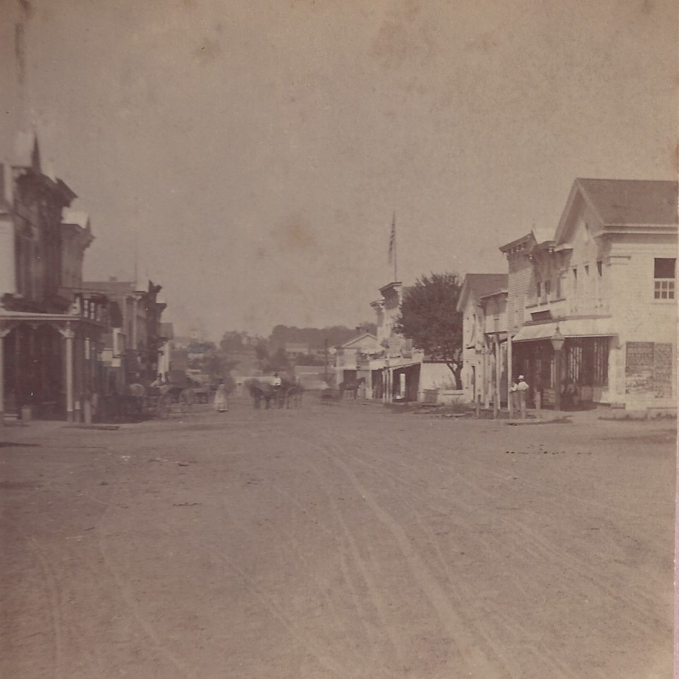
These early bridges served a small but growing milling and farming settlement; contemporary descriptions emphasize basic timber construction and unpaved approaches.
Double‑span iron bridge (c.1880–1921)
Around 1880 a double‑span iron bridge was erected on Main Street at the river, replacing the last of the wooden bridges. <ref name="Vol1p64" /> This first iron bridge carried a solid wood‑plank roadway, with a posted sign warning travelers that there was a fine for driving faster than a walk or for driving more than twenty‑five head of cattle on the bridge at one time. <ref name="Vol2p20">Vol2.pdf, p. 20.</ref>
In 1911 the wooden deck of the iron bridge was replaced by a concrete roadway slab, while the iron trusses themselves remained in use. <ref name="Vol1p64" /> Photographs from this period show the iron spans with a smooth, light‑colored deck surface and unpaved or only lightly improved Main Street approaches.
Present concrete bridge (1922–present)
In 1920 the village bonded for US$11,500 toward the construction of a new concrete bridge, with the township contributing an additional US$5,000. <ref name="Vol1p64" /> The iron bridge was dismantled in 1921 to make way for a three‑span reinforced‑concrete structure at the same crossing. <ref name="Vol1p64" />
The concrete bridge was completed in May 1922. It has three spans (60 feet in the center span and 54 feet at each end), with a 24‑foot roadway flanked by 6‑foot sidewalks. <ref name="Vol1p64" /> At the time of its opening, it was described as one of the finest bridges of its type in Michigan, with polished concrete surfaces “like marble” and ornamental posts carrying “boulevard lights” along both sides. <ref name="Vol2p26">Vol2.pdf, p. 26.</ref>
The boulevard lights proved attractive but troublesome to maintain; electrical issues, maintenance costs, and occasional vandalism led to their eventual removal, leaving the basic three‑span concrete structure that still carries Main Street over the Flint River. <ref name="Vol1p64" />
Temporary Oak Street bridge during construction (1921–1922)
During the replacement of the iron bridge, there would otherwise have been no convenient way for traffic to cross between the east and west sides of town. To avoid a long detour (there was no Elms Road bridge and no bridge for several miles to the north), a temporary wooden bridge was constructed at the extension of Oak Street, just east of the lumber yard. <ref name="Vol2p26" />
Traffic crossed the river on this temporary bridge, then followed a short detour route up the hill to Mary Street, east on Mary, and south on Maple back to Main Street. The temporary structure was removed soon after the concrete Main Street bridge opened in 1922. <ref name="Vol2p26" /> Contemporary notes also record that the county road commissioner initially proposed routing traffic over the existing railroad bridge, but railroad and milling interests refused permission, leading to the Oak Street solution instead. <ref name="HartV2p165">Hart - Flushing Through the Years, Vol. II - 1904 to 1924_Part1.pdf, p. 165.</ref>
Railroad bridge context
A separate railroad bridge over the Flint River, located a short distance from the Main Street crossing, provides additional dating clues for historic images. The first railroad bridge at Flushing was built in 1889 to serve the Hart Mill, Montgomery Mill, other industries and the electric light plant. <ref name="Vol1p95">Vol1.pdf, p. 95.</ref>
An ice gorge in 1903 caused severe flooding around the Hart Mill and dam but left the railroad bridge intact. In 1904, however, another massive ice gorge swept over the dam and destroyed the bridge. <ref name="Vol1p95" /> A second railroad bridge was built in 1906, but traffic declined steadily with the rise of trucking. The structure eventually stood idle, was considered a dangerous eyesore, and was removed in 1931. <ref name="Vol1p95" />
The stone railroad piers remained in the river until 1965, when they were removed along with remaining portions of the unsightly mill dam. <ref name="Vol1p95" /> Thus, in photographs of the downtown riverfront:
- a standing railroad bridge indicates a date between 1889 and 1931;
- isolated bridge piers without a superstructure indicate a date between 1931 and 1965; and
- the absence of both bridge and piers indicates a date after 1965.
Dam, river level and later riverfront changes
From the mid‑19th century onward, dams at Flushing backed the river into a millpond above the Main Street crossing. The dam created a small “waterfall” and provided water power for sawmills, flour mills and later industrial uses. <ref name="Vol1p83">Vol1.pdf, p. 83.</ref> Floods and ice gorges periodically damaged the dam, necessitating repairs and partial reconstruction. <ref name="Vol1p95" />
In 1965 the remaining dam structures near the downtown were removed along with the old railroad piers, returning the river more closely to its natural profile. <ref name="Vol1p95" /> Subsequent riverfront improvements included the Bicentennial Walkway, built in 1976 along the east bank from Main Street south into Riverside Park as part of the United States Bicentennial celebrations. <ref name="Vol1p144">Vol1.pdf, p. 144.</ref>
Use of bridge features for dating historic photographs
The Flushing Area Historical Society recommends the following visual cues when using the Main Street bridge and nearby structures to estimate the date of downtown river photographs:
- **Bridge type**:
- A simple timber bridge at Main Street suggests a date before the installation of the iron bridge (pre‑c.1880). <ref name="Vol1p64" />
- A double‑span iron truss bridge with a plank deck points to roughly 1880–1910. <ref name="Vol1p64" />
- The same iron trusses with a smooth concrete deck indicate approximately 1911–1921. <ref name="Vol1p64" />
- A three‑span concrete bridge with solid parapet rails identifies a date of 1922 or later. <ref name="Vol1p64" />
- **Ornamental lighting on the bridge**:
- Presence of decorative “boulevard lights” mounted on the bridge posts is characteristic of the early years of the concrete bridge (roughly the 1920s). <ref name="Vol1p64" />
- Absence of these lights, with only standard street lighting nearby, generally indicates a photograph from the 1930s or later. <ref name="Vol2p26" />
- **Railroad bridge and piers**:
- Railroad bridge visible: between 1889 and 1931. <ref name="Vol1p95" />
- Only stone piers in the river: between 1931 and 1965. <ref name="Vol1p95" />
- No bridge and no piers: 1965 or later. <ref name="Vol1p95" />
- **Street surface at the bridge approaches**:
- Dirt Main Street with board sidewalks at the east end of the bridge indicates pre‑paving conditions, especially before the mid‑1920s. <ref name="Vol1p65">Vol1.pdf, p. 65.</ref>
- A clearly paved Main Street in bridge views indicates a date after the first major paving projects of the 1920s. <ref name="Vol2p136">Vol2.pdf, p. 136.</ref>
Together, these structural and streetscape details allow researchers and collectors to assign approximate dates to many otherwise undated images of downtown Flushing and the Flint River crossing.